![](/images/other/stat-length.png)
![Trail Walking Le Tampon - Randos Festives du 11 octobre 2020 : La Boucle du Piton Dugain - Photo](https://media.geolcdn.com/t/1900/400/33beff6d-0f86-40b2-b917-6aa6f04188f8.jpg&format=pjpeg&maxdim=2)
Randos Festives du 11 octobre 2020 : La Boucle du Piton Dugain
GilbertLP
User
![Length](/images/other/stat-length.png)
Length
7 km
![Max alt](https://static1.geolcdn.com/siteimages/upload/files/1508320355ic_sort_altitude_max_24dp.png)
Max alt
1708 m
![Uphill gradient](https://static1.geolcdn.com/siteimages/upload/files/1508320355ic_sort_den_pos_24dp.png)
Uphill gradient
151 m
![Km-Effort](/images/other/stat-length.png)
Km-Effort
9 km
![Min alt](https://static1.geolcdn.com/siteimages/upload/files/1508320355ic_sort_altitude_min_24dp.png)
Min alt
1577 m
![Downhill gradient](https://static1.geolcdn.com/siteimages/upload/files/1508320355ic_sort_den_neg_24dp.png)
Downhill gradient
151 m
![Boucle](https://static1.geolcdn.com/siteimages/upload/files/16400158638029165_repeat_loop_refresh_sync_direction_icon.png)
Boucle
Yes
Creation date :
2020-09-04 11:58:19.769
Updated on :
2020-09-04 12:20:40.047
![Walking](https://static1.geolcdn.com/sitytour/trail-icons/101.png)
1h55
Difficulty : Medium
![Scan this QR Code to open this trail in the SityTrail application](https://capi.geolives.com/qq0zvz2zws4bq2lad0pu/sitytour/trails/2537579/qr.png?size=200)
FREE GPS app for hiking
About
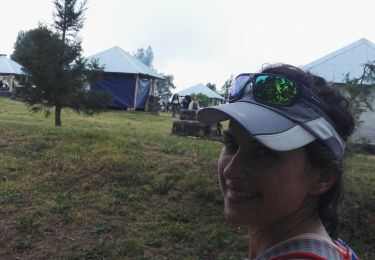
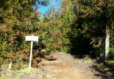
Trail Walking of 7 km to be discovered at Réunion, Unknown, Le Tampon. This trail is proposed by GilbertLP.
Description
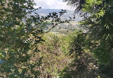
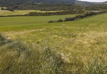
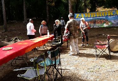
Chemins de traverse propose cette randonnée pour tous dans le cadre des Randos Festives du 11 octobre 2020. Elle peut être faite par tous marcheurs, en famille et offre de nombreux paysages dans la Plaine des Cafres, avec des vues enchanteresses sur le Piton des Neiges.
Positioning
Country:
France
Region :
Réunion
Department/Province :
Unknown
Municipality :
Le Tampon
Location:
Unknown
Start:(Dec)
Start:(UTM)
352076 ; 7654519 (40K) S.
Comments
Trails nearby
![Trail Walking Le Tampon - Grand Bassin à partir de Bois Court - Photo](https://media.geolcdn.com/t/375/260/546c7d2f-db6d-45ed-ad24-b006fb8e00d4.jpg&format=jpg&maxdim=2)
![Walking Walking](https://static1.geolcdn.com/sitytour/trail-icons/101.png)
Grand Bassin à partir de Bois Court
Walking
Difficult
(1)
Le Tampon,
Réunion,
Unknown,
France
![](/images/other/stat-length.png)
9.5 km | 22 km-effort
4h 23min
![](https://static1.geolcdn.com/siteimages/upload/files/16400158638029165_repeat_loop_refresh_sync_direction_icon.png)
Yes
![Trail Trail Le Tampon - Voile de la Mariée par Grand Bassin - Photo](https://media.geolcdn.com/t/375/260/5427d8f3-02fa-4d1e-bfb5-4fd763fbd394.jpg&format=jpg&maxdim=2)
![Trail Trail](https://static1.geolcdn.com/sitytour/trail-icons/104.png)
Voile de la Mariée par Grand Bassin
Trail
Difficult
Le Tampon,
Réunion,
Unknown,
France
![](/images/other/stat-length.png)
10.4 km | 25 km-effort
3h 20min
![](https://static1.geolcdn.com/siteimages/upload/files/16400158638029165_repeat_loop_refresh_sync_direction_icon.png)
Yes
![Trail On foot Le Tampon - 3 pitons à Bourg Murat - Photo](https://media.geolcdn.com/t/375/260/970bad91-7bf9-4096-b52f-d8b7555be2f2.jpg&format=jpg&maxdim=2)
![On foot On foot](https://static1.geolcdn.com/sitytour/trail-icons/100.png)
3 pitons à Bourg Murat
On foot
Medium
Le Tampon,
Réunion,
Unknown,
France
![](/images/other/stat-length.png)
12.4 km | 16.4 km-effort
Unknown
![](https://static1.geolcdn.com/siteimages/upload/files/16400158638029165_repeat_loop_refresh_sync_direction_icon.png)
Yes
![Trail Walking Le Tampon - bourg murat la fournaise - Photo](https://media.geolcdn.com/t/375/260/90df9966-627c-4173-ae45-ca4957fd7ec0.jpg&format=jpg&maxdim=2)
![Walking Walking](https://static1.geolcdn.com/sitytour/trail-icons/101.png)
bourg murat la fournaise
Walking
Difficult
Le Tampon,
Réunion,
Unknown,
France
![](/images/other/stat-length.png)
19.1 km | 29 km-effort
7h 38min
![](https://static1.geolcdn.com/siteimages/upload/files/16400158638029165_repeat_loop_refresh_sync_direction_icon.png)
No
![Trail Walking Le Tampon - grand bassin mollaret piton rando - Photo](https://media.geolcdn.com/t/375/260/ext.jpg?maxdim=2&url=https%3A%2F%2Fstatic1.geolcdn.com%2Fsiteimages%2Fupload%2Ffiles%2F1553511878bg_sport_marche.png)
![Walking Walking](https://static1.geolcdn.com/sitytour/trail-icons/101.png)
grand bassin mollaret piton rando
Walking
Difficult
(1)
Le Tampon,
Réunion,
Unknown,
France
![](/images/other/stat-length.png)
18.9 km | 37 km-effort
7h 30min
![](https://static1.geolcdn.com/siteimages/upload/files/16400158638029165_repeat_loop_refresh_sync_direction_icon.png)
Yes
![Trail Walking Le Tampon - Murat nez de bœuf - Photo](https://media.geolcdn.com/t/375/260/ext.jpg?maxdim=2&url=https%3A%2F%2Fstatic1.geolcdn.com%2Fsiteimages%2Fupload%2Ffiles%2F1553511878bg_sport_marche.png)
![Walking Walking](https://static1.geolcdn.com/sitytour/trail-icons/101.png)
Murat nez de bœuf
Walking
Very easy
(1)
Le Tampon,
Réunion,
Unknown,
France
![](/images/other/stat-length.png)
15.9 km | 23 km-effort
5h 23min
![](https://static1.geolcdn.com/siteimages/upload/files/16400158638029165_repeat_loop_refresh_sync_direction_icon.png)
Yes
![Trail Walking Le Tampon - Trous Blancs de Piton Sec - Photo](https://media.geolcdn.com/t/375/260/ext.jpg?maxdim=2&url=https%3A%2F%2Fservices.sitytrail.com%2FGeolivesWS%2FDownloadMedia.ashx%3FTrailID%3D452656%26Media%3Dfix__20150730105930.jpg)
![Walking Walking](https://static1.geolcdn.com/sitytour/trail-icons/101.png)
Trous Blancs de Piton Sec
Walking
Easy
(1)
Le Tampon,
Réunion,
Unknown,
France
![](/images/other/stat-length.png)
3.9 km | 6.1 km-effort
3h 4min
![](https://static1.geolcdn.com/siteimages/upload/files/16400158638029165_repeat_loop_refresh_sync_direction_icon.png)
Yes
![Trail Walking Le Tampon - La Réunion - Boucle des sources du Bras de Pontho par le Piton Guichard - Photo](https://media.geolcdn.com/t/375/260/ext.jpg?maxdim=2&url=https%3A%2F%2Fservices.sitytrail.com%2FGeolivesWS%2FDownloadMedia.ashx%3FTrailID%3D315245%26Media%3Dfix__20140622155133.jpg)
![Walking Walking](https://static1.geolcdn.com/sitytour/trail-icons/101.png)
La Réunion - Boucle des sources du Bras de Pontho par le Piton Guichard
Walking
Medium
Le Tampon,
Réunion,
Unknown,
France
![](/images/other/stat-length.png)
6.3 km | 9.8 km-effort
2h 3min
![](https://static1.geolcdn.com/siteimages/upload/files/16400158638029165_repeat_loop_refresh_sync_direction_icon.png)
No
![Trail Walking Le Tampon - Coteau Maigre - Photo](https://media.geolcdn.com/t/375/260/ext.jpg?maxdim=2&url=https%3A%2F%2Fstatic1.geolcdn.com%2Fsiteimages%2Fupload%2Ffiles%2F1553511878bg_sport_marche.png)
![Walking Walking](https://static1.geolcdn.com/sitytour/trail-icons/101.png)
Coteau Maigre
Walking
Difficult
(2)
Le Tampon,
Réunion,
Unknown,
France
![](/images/other/stat-length.png)
16.8 km | 26 km-effort
5h 26min
![](https://static1.geolcdn.com/siteimages/upload/files/16400158638029165_repeat_loop_refresh_sync_direction_icon.png)
Yes